
Yellowstone Maps
National Geographic Map Series
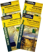 National Geographic Topographical Maps of Yellowstone
Topographical Maps of Yellowstone National Park. Each map covers one quarter of the Park. Most of our ski trails are covered on the Tower/Canyon and the Yellowstone Lake maps.
Maps from the United States Geological Survey
These 7 1/2 minute quadrangle maps provide plenty of detail for safe navigation through the Yellowstone Backcountry. The maps can be ordered for $6 each from the United States Geological Survey. We spend most of our days skiing in the areas covered by the Canyon, Mount Washburn, Crystal Falls, and Cook Peak quadrangles. A limited number of our trails are located in the Yellowstone Lake and Lake Butte quadrangles. The maps may be purchased online from http://www.usgs.gov.
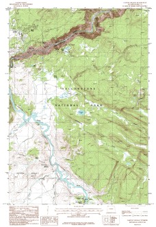 USGS Canyon Village, WY
By USGS. USGS Canyon Village, WY 1:24,000. This map covers the area around the "Yurt Camp". The map area covers the Canyon Rim Trails, the Roller Coaster, Forest Hot Springs, Wrangler Lake, and the Gorge of Sour Creek.
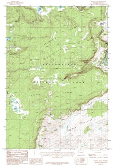
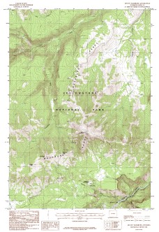 USGS Mount Washburn, WY
By USGS. USGS Mount Washburn, WY 1:24,000. This map covers the area to the north of the "Yurt Camp". The map covers the trails such as Dunraven Pass, Seven Mile Hole, Washburn Hot Springs, and Hedges and Dunraven Peaks.
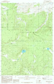
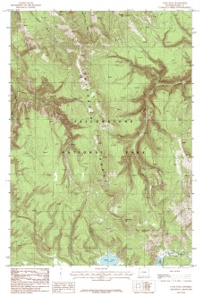 USGS Cook Peak, WY
By USGS. USGS Cook Peak, WY 1:24,000. This map covers the area to the northwest of the "Yurt Camp". The map covers the trails such as Cascade Lake, Observation Peak, and the Cascade/Washburn Ridge.
 USGS Crystal Falls, WY
By USGS. USGS Crystal Falls, WY 1:24,000. This map covers the area to the southwest of the "Yurt Camp". The map covers the trails such as Alum Creek, Violet Hot Springs, Otter Creek, the Chain of Lakes, Cygnet Lakes, the Brink of the Upper Falls, and the trail to Glen Africa Basin.
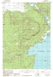 USGS Yellowstone Lake, WY
By USGS. USGS Lake, WY 1:24,000. This map covers the area south of the "Yurt Camp" and to the northwest of Yellowstone Lake. The map area covers the Mud Volcano, Natural Bridge, and Gull Point trails.
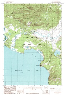 USGS Lake Butte, WY
By USGS. USGS Lake Butte, WY 1:24,000. This map covers the area south of the "Yurt Camp" and to the northeast of Yellowstone Lake. The map area covers the Pelican Creek, Valley of Death, and Turbid Lake trails.
 USGS Beach Lake, WY
By USGS. USGS Beach Lake, WY 1:24,000. This map covers the area toward the southwest corner of Hayden Valley. The map area covers the Glenn Africa trail and the last portion of the Driad Lake trail.